3D laser scanning technology is one of the most effective tools available to help increase the efficiency of construction work, reduce costs, improve quality, and increase the durability and sustainability of projects. Using this measurement technology, it is possible to make effective decisions already in the early stages of construction, thus avoiding errors and changes in deadlines.
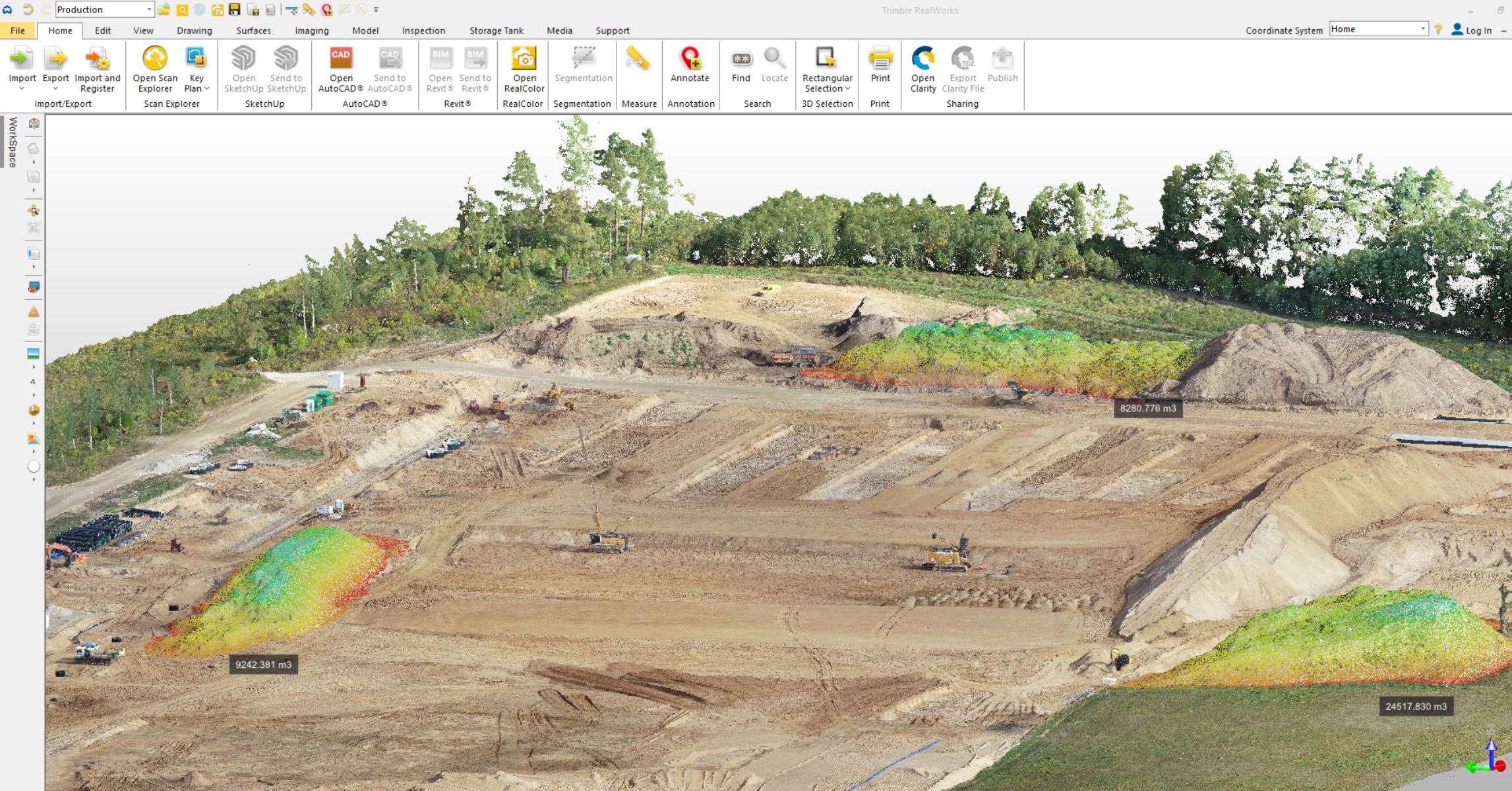
In the following case study, “Terra Modus” undertook an ambitious task to perform detailed measurements of land volumes and floor flatness at a logistics centre construction project covering an area of almost 63,000 square meters. Doing this with the help of drones and 3D laser scanners.
The first stage of construction is accurate measurements of land quantities
UAB “Terra Modus” started the work on the construction site with a detailed measurement of the amount of land, thus ensuring that every cubic metre was carefully measured.

UAB “Terra Modus” started the work on the construction site with a detailed measurement of the amount of land, thus ensuring that every cubic metre was carefully measured.
In the first stage of construction, the calculation of volumes requires accurate land surface measurements in order to make a precise estimate. Making it possible to select the right amount of machinery and to calculate the deadline for completing the work. This accuracy reducing the risks for both the client and the contractor. With the help of drones, it is also possible to monitor the progress of earthworks and the movement of materials on the construction site.
The second stage is scanning the floor covering
In the construction of production, logistics, and other industrial buildings, the smoothness of the floor covering is very important, as it ensures production equipment can be installed safely and functions properly. The flatness of the floor is also one of the most important factors to guarantee the safety, stability, and functionality of the building.
In the construction project carried out by Terra Modus’ client, the accuracy and smoothness of the floor covering was measured with the help of 3D scanning technology. The total scanned area of the floor was 63,000 square metres. About 120-140 scanning positions were performed each day covering an area up to 8000-9000 square metres, and which corresponded to an altitude density of 8000 points per square metre. After scanning the entire area, the obtained data could be used and analysed, with the possibility of generating altitude indicators and densities greater than 1 meter. Eliminating the need to go back and measure again, as would be the case with traditional measurement methods.
Stages of measurements:
- Scanning of the leveling layer – soil scanning
- Scanning of the floor covering (concrete) layer
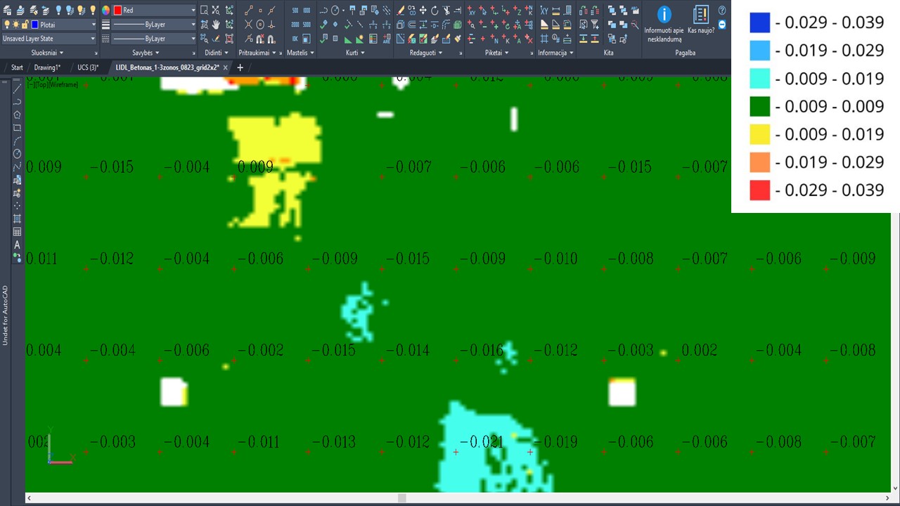
When measuring the surface of the floor, laser scanning enables the rapid collection of large amounts of data in a very short time and ensures precise accuracy compared to conventional measuring methods. Such efficiency is very important in large construction projects. After scanning, a report was created for the customer, which clearly showed the tolerance limits and deviations.

A report was drawn up for the customer after scanning, which clearly shows the tolerance limits and deviations.
The colour scale of the map can be adjusted to meet the exact tolerance requirements of the structure, allowing a contractor to quickly and confidently correct height discrepancies.
Using these modern measurement technologies not only ensured the smooth implementation of the project, but also made it possible to calculate risks, avoid errors, and reduce time costs.
Considering delving into the world of laser scanning data, but not sure where to begin?
With experience dating back to 2007, our knowledge enables us to customize even the most advanced technologies to meet the unique needs of each client.
